Yes, and finally some dared for a Multi User-purpose Jordanian GIS System, something that would give the user in Jordan services Google Earth gives it's users in Europe and the US. Something that provides the visitors to Jordan as well as the residents, the information about “Where can you go to Jordan”, from Historical and archaeological sites, Hotels, and entertainment places, to Services, associates, and government offices and ministries. And “How can you Go” to that place,providing the exact location and area in which the place exists, and the entire network of roads and highways all over the country!
People of Jordan, Jordan TourXplorer is HERE!
100% made in Jordan, 100% Jordanian IT students made! (A.K.A. IN HOUSE DEVELOPMENT).
This semester, four students from the faculty of Information Technology - Software Engineering Department at the Hashemite University submitted their Graduation project, Jordan TourXplorer, after 3.5 months of continuous investigation, analysis, design and implementation, making the dream of one of the group members come true.
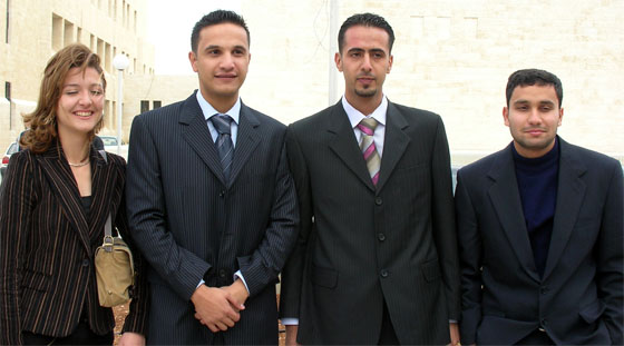
Muna Jaber, Esam Bdair, Abdallah Malaka, and Khaled Zuhair made the 1st ever Usable GIS system for Jordan, a simple software that integrates multiple layers and platforms of data and generates a User attractive experience about jordan for the user on his PC or PDA.
The Project, an idea of Abdallah Malaka inspired from the very famous Google Earth, was to be , as Abdallah says, an Idea to support the Tourism in Jordan, providing the user with an exact and real geographical description of jordan, the governates, main cities and towns, and natural geographical elements across jordan, and their relation to the Historical and Archaeological sites across Jordan, along with Full Information about the Governate, it's center City, and All the sites in it. On the other side, and since No nation wide GIS or GPS system is available in Jordan, came the urge of providing as many as possible other services integrated in the software, and there it was, the software included each and every area in the governates across Jordan, and Areas and sectors in the Capital, along with all the roads and highways across Jordan inside and outside Cities, All the Hotels, Associates, ATMs, Entertainment Places, Airline Offices, Car rental Offices, Banks, Restaurants, Government Offices, and much more sorts of services the user being a visitor or a resident might be interested in.
Amazing isn't it?!
Now Comes the real work...
Data Needed,
GIS Platform Needed,
As far as finding a suitable GIS system, many have been found. Different GIS frameworks and Software packages where found, all implementing similar techniques of Having the Model stored in databases and rendered as layers on graphical maps or yet other layers. Decision was made to use Geomedia, since it supports multiple platforms of models and data, it's components can be integrated and controlled from within Micorsoft.NET framework, that is, the development technology adopted by the group, and the most important reason: Having collected the data in a wide range of models, formats and platforms, that is, the other half of the problems they faced along the duration of the project!
Other reasons were that, Google Earth it self uses components from Geomedia's GIS system, and the fact that Geomedia have good support in Jordan, provided by GCE-Soft, who supported them with a Free Copy of the software, APIs, methodologies, and even some sort of data ;)
Next comes the Jordanian Mission Impossible, DATA GATHERING!
Unfortunately, The National Information Center, The Royal Geographical Center, The Ministries of Tourism, Public Work, Local Administration, and others, none provided the needed or the aimed help or data for the group, this stage took them just over 5 consecutive weeks, and they didn't really get what they wanted from these Governmental divisions.
As Esam and Abdallah say: “All of them thought we are just kids missing around! despite we had official papers from the university asking support from those Places. All of them were making fun of us and we are doing; that urged the challenge spirit deep inside of us to go as far as possible with the project.” “I really hope they'll get convinced now by our abilities” Muna says, “and even get interested in the project it self”. Ahh! Not to forget the bureaucracy of getting a paper from the university nowadays since the current President doesn't want any official paper to be issue by the name of university without his signature on it!
Now in order to make your self feel like if you are really in Jordan, the data format gathered from each and every place was completely different from the others! Microsoft Access, FoxPro, mico-station, shapefile, and other formats of data were gathered, even AutoCad files including data models where gathered (Now you tell me what's e-Gov with all of these file formats around!). Having choose Geomedia as a GIS platform helped them, but still, processing and choosing the suitable needed data took time even using Geomedia. Geomedia's role as Esam says was mainly registering the image for the coordinates and data models to be layered on it.
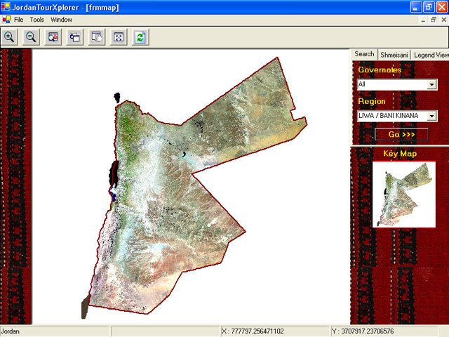
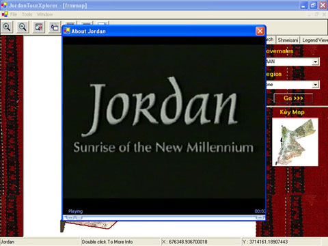
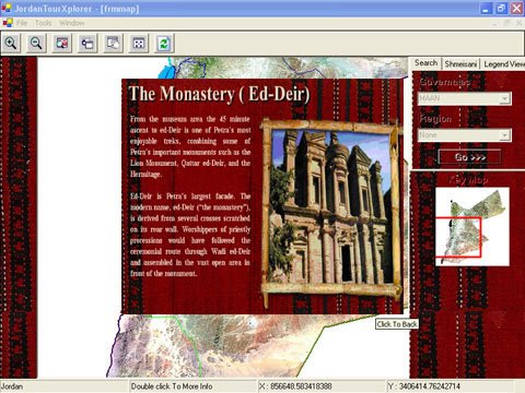
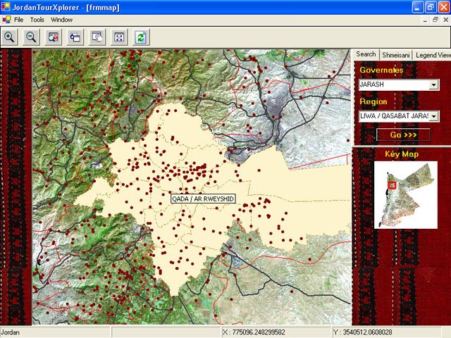
Getting into the software, as available in the screenshots provided by the damn good fellow programmer and friend, Esam ;) Moving throughout the map and zooming can be done using the mouse, zooming into the picture will show the borders of governates, and deeper the borders of Administrative Region and municipalities, as well as the roads and highways network. Tool-tips are available everywhere on all the levels of zooming mentioning the pointed-to location.
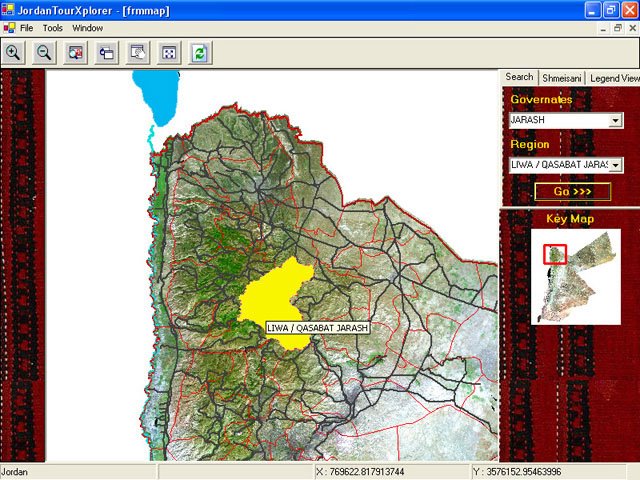
Search Tab on the right part enables you to choose a governate and an Administrative Region in it, and will lead the user to that region and highlight it.
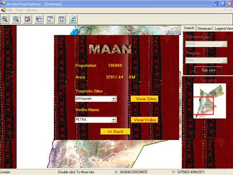
More service was provided in greater amman area, providing indications for spots, services and locations across the capital. The Group was lucky to get a TIFF Satellite Image for SHMEISANI through GCE-soft (No It's not from Google Earth). Thus, As much Information as possible was gathered for shmeisani, integrated, and turning it to a so-called “Full Service Coverage” area in the project. Shmeisani was simply the proof of how much could the group provide with their software, all using data available around the governmental offices and ministries, but not organized nor structured in a way that may provide useful integrated information for people. Is it a lack of care regarding having centralized integrable data for the Jordanian Government along the time, or a Lack of communication and group work between parts and divisions of a single government across those years, or simply both!
As seen in this General Shmeisani preview, you can mention the facts that sectors and area's in the capital are separated by main streets.

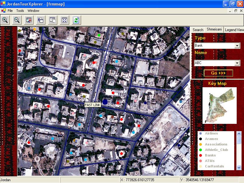
A Special Tab for Shmeisani was provided, with a search for a type of services needed, choosing a service will provide all the places/service providers in the area and lead you to the choosed one.
In this Screen shot, ABC Bank was have been chosen, the map was centered at the search location and the location was highlighted with a big Blue Dot.
Yes, This shot shows the Culture Street in Shmeisani, along with all the services in the area represented in colored dots, each color representing a type of service or location, rolling over a dot will show the name of location, for example, rolling over that dark green dot representing companies, a tool-tip mentioning it's “FASTLINK” appeared.
Interesting!
Now will anybody in the jordanian Government care about such a software many people had a resolution about in the media, and even here in JordanPlanet.net ?! (Of Course, we have all sorts of everything in Jordan Planet :)
and Just to mention, the Software is 100% modular and Object oriented, making it more than easy to add any area of service along with it's satellite image and services to the software. I told you Esam is damn good ;)
and hey, not to forget Khaled's (A.K.A Kreative's) PDA software (sorry for not having any screen shots at the moment. Making such a software available anywhere for business men that don't really have time (or care) to know each and everyplace in the capital but care to find it, and as soon as possible, along with information about the places, such as Contact Numbers and Website. The PDA application is more like a directory about the places and services within a new approach and experience, that is since extensive zooming is cannot be applied on the PDA's because of space and Hardware performance limitations.
Finally comes my greetings for the group. Muna, Abdallah and Khaled are graduating now, while Esam is graduating with me in June... I'm really proud of them, they where just another proof for the nation that the 2002 IT group simply roxx!
Probably they had loads of mistakes in their english language used in the documentation (which wasnt really as it should have been for such a project) along with some expression and spelling mistakes in the labels and buttons inside the software it self, I mean , U could have asked for help guys ;P though secracy is a must in such projects..
Think Big Guys!
And people of Jordan, there you have it, Jordan TourXplorer,your future virtual guide across Jordan ;)
5 comments:
ya3teeekom el 3afieh , bs where can we try it ?!
Cooool.. that's amazing. Way to go guys. Ya3teekom el 3afyeh.
Hi Naseem: I wouldn't call the project as GIS softwareproject, but a GIS database. The screenshots look great, and I beleive that the idea is to put it on the web, so I will look forward to that. Maybe you can convince HU to host it on their site.
The data needed is available in many places, including the departments mentioned in your post. Unfortunately, the data is for sale and is very expensive. The data is not always internally consistent. I am sure you now realize this.
There is business potential for this project, as it is perfect for tourism marketing as well as for Jordanians interested in knowing more about the geography of Jordan, so it might be worth the investment to pay for some more data. Just a thought.
As I said, I look forward to seeing it on the web. If this happens, please let us know.
actually the student's aim is the project to be adopted by the some1 in the government, they've designed it 100% modularly and used multiple data platforms just to cope with the realiy of it being applied for jordan :P
hehe..
The software is not Webbased, as it needs special components, it's available in Desktop software and PDA software.
The concept of it being a desktop software is to run on PCs in public places, Touristical places and hotels.
QAIA, Aqaba Airport, Malls, even restaurants and indoor hangout places are suitable places for such software to running at, not forgetting visitors centers and musiums, even embassys abroad and RJ offices are suitable places to run such a software.
first nasim u r soooo great,,,
and this project is really cool,,i hope the best for esam,abdulla,khaled and muna,
and nasim ,,wish luck to u to0
Mohamad Bdair
Post a Comment